Nearly Every USGS Topo Map Ever Made. For Free.
The U.S. Geological Survey (USGS) has been producing detailed topographic maps for more than 125 years. Today they are nearly all digitized and free to download through the USGS Map Store, an incredible treasure trove for both map junkies and casual hikers alike.
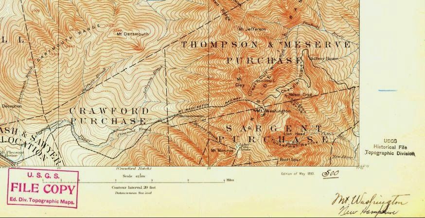 |
|A section of an 1893 USGS topo map for Mount Washington, downloaded for free from the USGS Map Store |
Locating your desired map is straightforward with the USGS Map Locator and Downloader, which allows you to zoom in or search for your area of interest. It then gets mildly confusing (though easy once you figure it out) to download the actual map.
To do so, find your desired location and select the type of map you wish to download (usually the 7.5-minute versions, which provide the most detail). An overlay grid appears, with each box labeled with the specific name of each map.
Next mark a point within your desired map by first selecting the button next to “Mark Points” and then clicking anywhere within the area of interest. This adds a reddish ‘paddle’ to the map. (If you searched by name, a paddle will automatically appear over the location.) Clicking on it then brings up a list of all the maps available for download for this location, from most recent to historic.
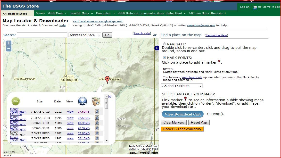 |
|Screenshot showing available topo maps for Mount Washington, New Hampshire, including historical maps dating back to the 1890s. |
One important thing to note is that, in general, the most recent topo maps listed are markedly different from their predecessors. Part of the new US Topo Series, these maps have been created as PDFs with geospatial extensions (GeoPDF), which gives you the ability to turn on and off different layers (contour lines, place names, water features, etc.) for viewing, depending on what information you are interested in. Unfortunately, however, trails are not currently included as one of these layers—a significant drawback for hiking.
Lastly, and one of the single-most useful online tools I’ve discovered in recent years, is the ability to overlay every USGS topo map on top of Google Earth, another free (and extremely powerful) tool to add to your trip planning quiver.
“Equipped” is an AMC Outdoors blog, written by Matt Heid.